![]()
Fast Transit in Vancouver and Surrounding Cities
Transit across the Lower Mainland has been improving consistently over the years, with more improvements to come. The transit system gives people more options when it comes to where they live, and helps families who work in different cities every day. The Vancouver / Lower Mainland transit system extends north to North Van, east to Port Moody, Burnaby, New West, Coquitlam, Surrey, Mission, Maple Ridge, and south to Richmond and YVR Airport. Along with great bike paths you’ll find the following routes:
- the Canada Line Skytrain connecting Vancouver to Richmond and YVR Airport
- a multi-faceted Skytrain connecting Vancouver-Burnaby-Port Moody-New Westminster-Surrey
- a Seabus connecting Vancouver to North Vancouver
- the West Coast Express connecting Vancouver-Port-Moody-Coquitlam-Port Coquitlam-Pitt Meadows-Maple Ridge-Pitt Meadows
- a thorough network of Bus routes
- Translink is working with the Municipal and Provincial Government to add a new Subway line from VCC-Clark Station (at Clark and Great Northern Way) along Broadway heading west to Main, Cambie, Oak, Granville and Arbutus St, with the potential to eventually extend this line to Alma St and then UBC. For more information: Broadway Subway Project.
Have a look at the above map of your transit options including major bus routes (double click the picture to enlarge it) and check out the Translink website for more detailed information on routes available: translink.ca. Here is a link to Translink’s Trip Planner to give you the best options in getting from Point A to Point B: https://new.translink.ca/trip-planner.
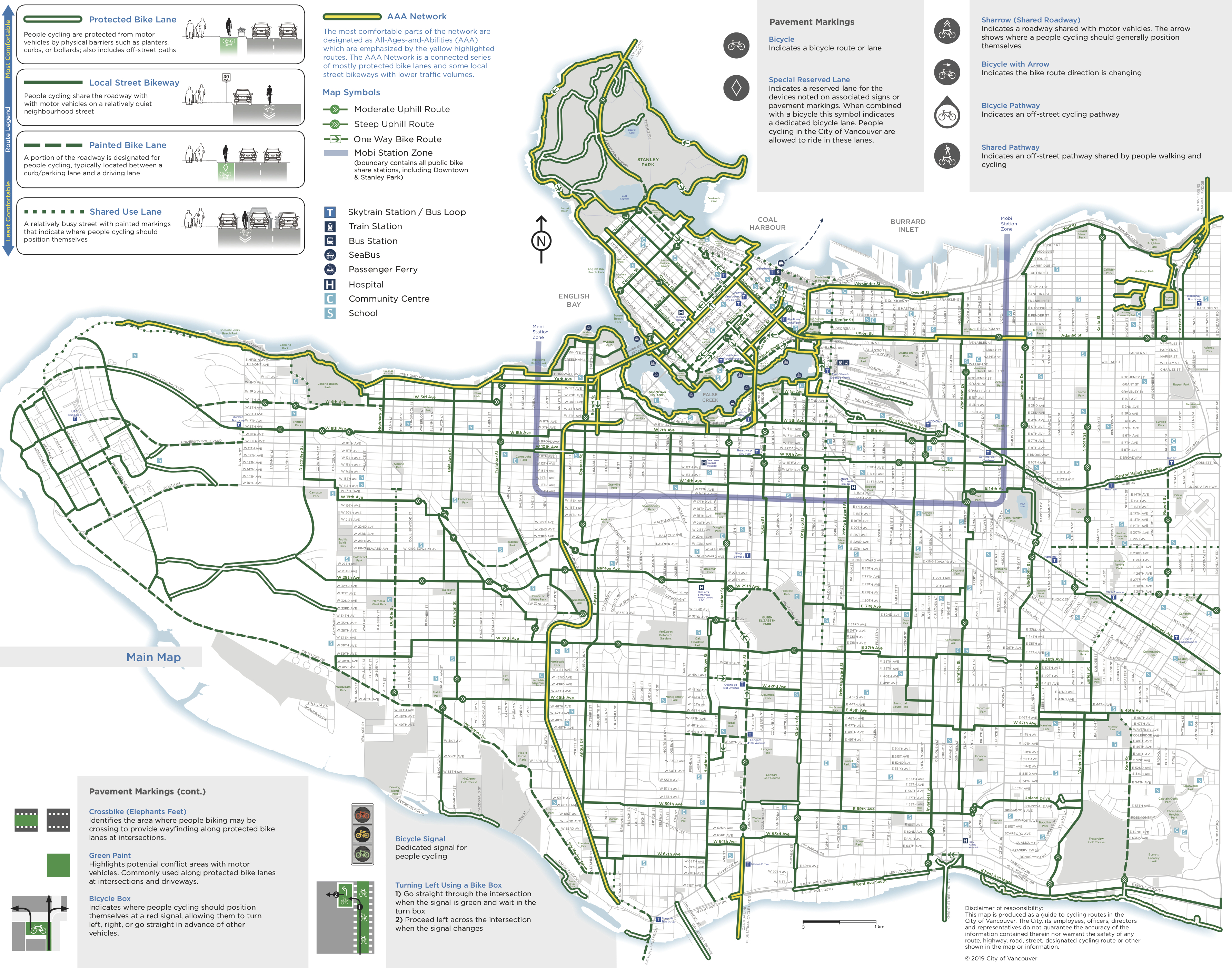
Vancouver Bike Paths
Vancouver has a great cycling network of bike streets, bike lines, protected bike lanes and air pumps. Have a look at the map below for a comprehensive view of your options, and head to the City website for more information: Vancouver Cycling Routes.